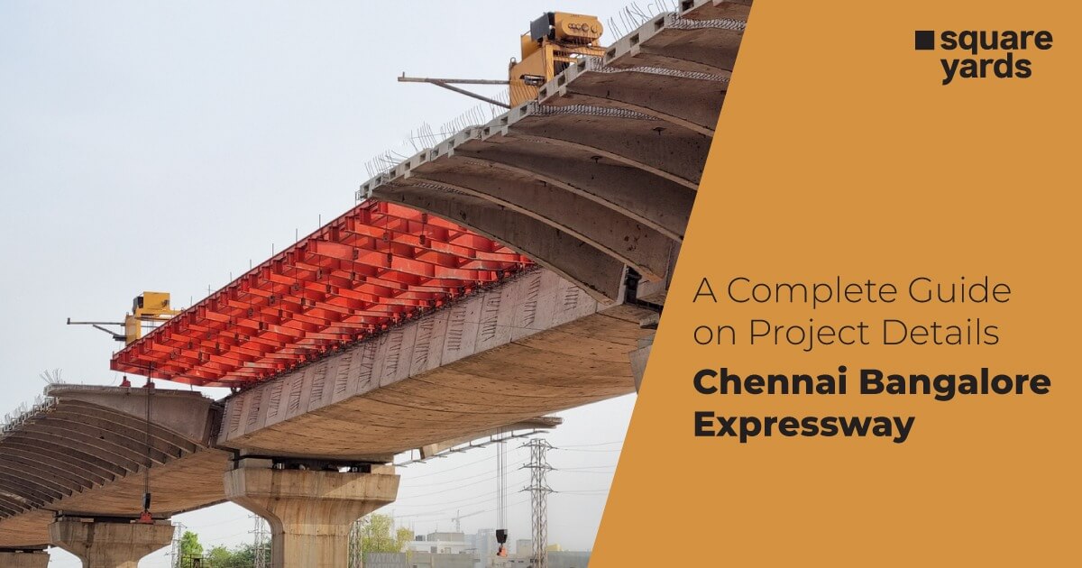
A green initiative by the Indian Government in developing world-class expressways across India, the Chennai-Bangalore expressway, officially known as NE-7, intends to connect vibrant metropolitan cities in a short period of time. The much-awaited expressway goes beyond infrastructure and fuses economic activities between the two southern cities. The access-controlled corridor will help commuters reach their destination in around two-three hours. Developed and implemented by the NHAI-National Highways Authority of India, the project is divided into four phases at an estimated cost of Rs 18,000 crore.
Table of contents
- About Chennai-Bangalore Expressway
- Design Chennai Bangalore Expressway
- Key Facts Chennai Bangalore Expressway Project
- Real Estate Growth in Chennai Bangalore Expressway
- Top Residential Projects in BCE Expressway
- Current Status of Chennai Bangalore Expressway
- Chennai Bangalore Expressway Route
- Chennai Bangalore Expressway Speed Limit
- Chennai Bangalore Expressway Map
- Proposed Chennai Bangalore Expressway Toll and Rates
- Chennai Bangalore Expressway Distance
- Conclusion
- FAQ
About Chennai-Bangalore Expressway
The four-lane elevated expressway binds three states together: Karnataka, Andhra Pradesh, and Tamil Nadu. This project was first announced in 2011 and is now being built under the Bharatmala Pariyojana initiative. Prime Minister Narendra Modi laid the foundation stone of the expressway in May 2022. Scroll below to learn more about the project, which will accelerate real estate and industrial growth.
Design Chennai Bangalore Expressway
Initially planned as an eight-lane highway that would have a fully accessed control high-speed facility from the start, the design of the proposed expressway was reduced to four lanes in the middle of 2020 to assimilate anticipated corridor traffic. The integrated project’s construction and operations will allow for future extensions- up to eight lanes.
The Bangalore Chennai Expressway is of paramount importance to establish feasibility between the cities and the corresponding areas. The expressway is designed and planned so that vehicles can run as fast as 120 KmPH on the passageway. Appropriate measures have been taken under the natural environment, human habitation, wildlife encroachment, and protection of heritage sites to make the expressway completely access-controlled. It will allow seamless traffic movement without any hindrance to life and property.
The Greenfield Expressway starts from- Hoskote Karnataka, passes via Malur, follows, Andhra Pradesh, and ends at Sriperumbudur Chennai. The corridor has been divided into four phases, 11 packages and passes through several canals and other water bodies.
- 75.64 kilometres in Karnataka,
- 88.30 kilometres in Andhra Pradesh
- 98.32 kilometres in Tamil Nadu.
Key Facts Chennai Bangalore Expressway Project
| Estimated Cost | Rs. 18,000 crore |
| Completion Date | 2025 |
| Expressway’s Length | 260.85 km |
| States Covered | Karnataka, Andhra Pradesh and Tamil Nadu |
| Total Lanes | 4( expendable 8) |
| Permitted Speed Limit | 120 kmph |
| Govt Agency | National Highway Authority of India (NHAI) |
| Expressway Project Model | Hybrid Annuity Model (HAM) |
Real Estate Growth in Chennai Bangalore Expressway
Bangalore and Chennai- the metropolitan cities attract immigrants from across the country. The proposed highway is part of the 26 new green expressways announced by the Central Government body, which will enhance connectivity and initiate industrial and residential development in the nearby areas. The automobile behemoths like Bajaj, Nissan and Mahindra are set to establish plants along this corridor route. With growth planned in the micro-markets of surrounding areas along the Bangalore-Chennai expressway hold immense potential among buyers.
“The project will increase economic activity in the region by opening up new areas for industrial development. There is potential for manufacturing facilities and warehousing facilities along the corridor. Also, the project will be closer to the port and facilitate easy cargo movement on the corridor,” stated CREDAI Tamil Nadu state president Suresh Krishna.
Top Residential Projects in BCE Expressway
The Bangalore-Chennai corridor will see significant real estate growth in the upcoming years. As the construction commences, it will induce economic activities and elevate the speed of commutes in the region. The 262 km route will offer eminent opportunities for various sectors, including industrial, residential, automobile and electronics, warehousing and logistics, etc.
The satellite towns Hoskote and Sriperumbudur will witness immense development in the education and manufacturing sectors that boasts social infrastructure scope for housing to accommodate the employees working in these sectors.
Current Status of Chennai Bangalore Expressway
In the first week of January 2023, the Union Minister for Road Transport and Highways, Nitin Gadkari, conducted an aerial survey of the expressway construction with the PWD minister and local authorities and shared the details on his Twitter account.
“Inspected the progress of the Bangalore-Chennai Expressway. We’re constructing this 262 km long 8-Lane structure worth Rs. 16,730 Crores.”
Further, the minister added “The project will be cost-efficient for vehicle operators and lessen fuel consumption. It will strengthen the economic activities in Bengaluru and Chennai and also connect industrial hubs in Karnataka and Andhra Pradesh to the Chennai Port.”
This new greenfield project will reduce the distance between the southern metros- Bengaluru and Chennai from 300km to 262km. The implementing agency NHAI has divided this project into three phases of the design construction and stated to be completed by March 2024.
Chennai Bangalore Expressway Route
The Chennai Bangalore Expressway will shorten the distance between the two cities from 300km to 262km and pass through the below-mentioned cities and States-
- Hoskote, Karnataka
- Malur, Karnataka
- Venkatagirikota, Andhra Pradesh
- Palamaner, Andhra Pradesh
- Gudiyatham, Tamil Nadu
- Arakkonam, Tamil Nadu
- Sriperumbudur, Tamil Nadu
At present, Bangalore and Chennai is connected by three other routes- Hosur and Krishnagiri, best known as the Golden Quadrilateral is preferably used other than the Old Madras Road, and Kolar-KGF-Venkatagirikota and Vellore. The upcoming expressway will facilitate travelers reach their destination in just three-four hours.
Chennai Bangalore Expressway Speed Limit
Currently, the distance between Bengaluru and Chennai is around 350 kms, but with the upcoming expressway, the new road will shorten the distance to 262 kms. With a whopping speed of 120 kilometres per hour, the travel time will reduce remarkably to only three to four hours. The cost-efficient project is four lanes from Hoskote Bengaluru, Karnataka, to Sriperumbudur Chennai, Tamil Nadu.
The expressway will boost the economy between Bengaluru and Chennai as several industrial hubs are set parallel to this route which will give a fillip to trade and commerce. The NH authorities have intercepted peak traffic of about 45,000 to 60,000 travellers of car units per day along this proposed green highway.
Chennai Bangalore Expressway Map
This is the Bangalore Chennai Expressway (BCE) route map, which displays the passage route and the cities on which the expressway is being constructed.
Proposed Chennai Bangalore Expressway Toll and Rates
As the expressway is still under wraps given below are the proposed toll rates as per the vehicle type:-
| Type of Vehicle | Rate |
|---|---|
| Lightweight transport vehicles | 0.65/km |
| Large goods transport Vehicle Minibuses | 1.05/km |
| Buses and Trucks | 2.20/km |
| 3-axle Trucks | 2.40/km |
| Multi-axle Trucks. | 3.45/km |
| Oversized Trucks | 4.20/km |
Chennai Bangalore Expressway Distance
The planned Bengaluru – Chennai Expressway (BCE) project, widely known as NE-7, covers a distance of 260.85 km. The four-lane Greenfield expressway will take commuters from Hoskote near Bengaluru, Karnataka, ending to Sriperumbudur near Chennai, Tamil Nadu.
Conclusion
The 262 km Chennai Bangalore Expressway will be a four-lane vital corridor that will connect three states- Karnataka, Andhra Pradesh and Tamil Nadu. the main objective of the expressway is to enhance the feasibility between Bangalore and Chennai, reducing the travel time and offering economic and financial viability to the people living in these cities. For more information and updates on real estate, feel free to contact the experts at Square Yards.
FAQ
How long is the length of the Chennai Bangalore Expressway?
The Chennai Bangalore Expressway is a 262 km- a 4-lane wide long corridor, the first among 26 green expressways initiated by the Central Government.
What is the Chennai-Bangalore Expressway route?
The corridor route runs through Hoskote, Malur, V Kota, Palamaner, Gudiyatham, Arakkonam, and Sriperumbudur respectively.
When was this expressway declared as a National Expressway?
Bangalore Chennai Expressway was designated as National Expressway on January 2021. It aims to reduce travel time for commuters and bring more employment opportunities and real estate development for the people living in the cities.
How many expressways are there in India?
As of July 2022, a total of 24 expressways are operational in the country.


